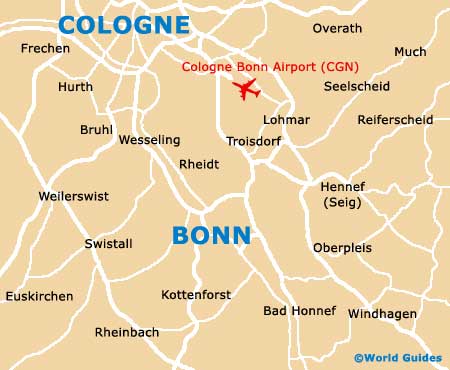
Cologne Bonn Airport (CGN)
Orientation and Maps
(Cologne, Germany)
Known locally as 'Köln', Cologne has become the biggest and most important city in the whole of the North Rhine-Westphalia (Nordrhein-Westfalen) area of western Germany. Known for its tourist appeal and beauty, anyone driving through Germany should be sure to stop at the city of Cologne.
Famous for its architecture, breathtaking cathedrals and public buildings, Cologne contains a number of internationally acclaimed museums, together with a busy airport, on the south-eastern outskirts.
Cologne Bonn Airport (CGN) Maps: Important City Districts
Close to Cologne, Dusseldorf lies just 32 km / 20 miles the north and be reached in less than 30 minutes. Other areas of interest nearby include Aachen and Stolberg (Rheinland) to the west, and Gummersbach to the east.
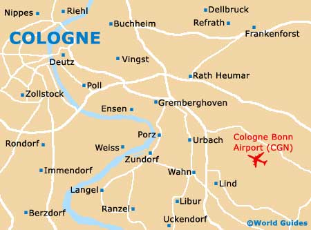
The city itself is centred around the Rhine River and the overall cityscape is dominated by Cologne's imposing cathedral, the 'Kölner Dom', which boasts twin spires. Those visiting Cologne and looking for the best place to shop should head to the Hohe Strasse street, a pedestrianised area located on the southern side of the cathedral.
To the north you will find the 'Hauptbahnhof' train station, which is just a short walk from most attractions around central Cologne. The 'Busbahnhof' bus station also resides in this area, being situated on the Breslauer Platz. A host of restaurants and places to eat out can be found in the Altstadt area, alongside the western banks of the meandering Rhine River and close to the Friesenplatz.
Germany Map

Cologne Map